Historic Districts of Woodbury, Connecticut
Woodbury Historic District No. 1
Woodbury Historic District No. 1 was named by the National Park Service to the National Register of Historic Places on February 22, 1971 under four criteria - (1) Architecture, (2) Agriculture, (3) Art, (4) Military. NRHP Reference number: 71000908. Architectural period covered: 1674 - 1969. Constance Luyster, Administrative Trainee at the Connecticut Historical Commission in Hartford, prepared the nomination and submitted it to the National Park Service on November 5, 1970.
In the nomination to the National Park Service, as of 1969, there were one hundred forty-two houses, five public buildings, three greens, two schools, five churches, four religious properties and three privately supported historic structures. Some houses still stand which were built as early as 1680. In general a continuous series of houses exist which embody the history of the town from 1674 to the present.
The numbers of houses of each historical period were: (1) The Early Colonial Period (1674-1740) 13; (2) The Late Colonial Period (1741-17S8) 17; (3) The Federal Period(1789-1828) 22; (4) The Pre-Civil War Period (1829-1865) 36; (5) The Post Civil War Period (1866-1900) 17; (6) The 20th Century Period (1901-1969) 37.
The Woodbury Historic District No. 1 encompasses approximately 200 acres, including two miles of Woodbury's Main Street and two miles of numerous adjacent side streets. Although the district is primarily residential in character, it also serves as a commercial area and as a center of town government. The nomination document classifies the district as containing Private Residences, Commercial, Government, Religious and Educational buildings. It should be noted that the Mitchell Elementary School and the Woodbury Middle School are not within the district. Also included in the district are two museums (Glebe House and Hurd House), and two parks (Orenaug Park, The Hollow Park).1 2
Footnotes
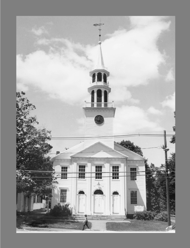
1. In the Nomination document to the National Park Service for Woodbury Historic District No. 1, every photograph included in the Nomination has been printed in reverse. For example, the two photographs of Saint Paul's Episcopal Church incorrectly show the parish hall and Sycamore Avenue on the left, or south side, of the church. The editor of this webpage corrected the photograph of Saint Paul's Church included on this webpage.References
- A Report of the Historic District Study Committee. Woodbury, Connecticut, February 1969
- Crofut, F. S, Marcy, Guide to the History of the Historic Sites of Connecticut. New Haven, Yale University Press, 1937.
- National Archives and Records Administration: "Woodbury Historic District No. 1, Woodbury, Connecticut" [https://catalog.archives.gov/id/71000908]
Woodbury Historic District No. 2
Woodbury Historic District No. 2 was named by the National Park Service to the National Register of Historic Places on February 23, 1972 under two criteria - (1) Architecture, (2) Military. NRHP Reference number: 132355009. Susan Babbitt, Administrative Trainee at the Connecticut Historical Commission in Hartford, prepared the nomination and submitted it to the National Park Service on November 19, 1970. The NPS returned the nomination for missing information. The nomination was resubmitted on November 30, 1971.
The Woodbury Historic District No. 2 is a residential area, bounded by open fields and woods. Its southern boundary line is the town line of Woodbury and Southbury, where Southbury's Historic Distinct begins, creating an unbroken stretch of three miles along U.S. Route 6 where houses built before 1828 predominate. The second Historic District is important because its architecture and historic sites embody the history of the area since the seventeenth century. Some of Woodbury's finest old homes lie in the one-mile district between the town line and the commercial area, the District's northern boundary.
The numbers of houses of each historical period were: (1) The Early Colonial Period (1674-1740) 1; (2) The Late Colonial Period (1741-17S8) 4; (3) The Federal Period(1789-1828) 2; (4) The Pre-Civil War Period (1829-1865) 1; (5) The Post Civil War Period (1866-1900) 6; (6) The 20th Century Period (1901-1969) 13.
Hotchkissville Historic District, Woodbury, Connecticut
Hotchkissville Historic District, Woodbury, Connecticut was named by the National Park Service to the National Register of Historic Places on on December 6, 1996 under three criteria - (1) Architecture, (2) Social History, (3) Industry. NRHP Reference number: 96001460. Architectural period covered: 1750 - c. 1940. Janice Cunningham, National Register Consultant in Middletown, prepared the nomination and submitted it to the National Park Service on November 5, 1970.
The early 19th Century origins of the Hotchkissville District's architecture were primarily Colonial in design. As the district prospered after the Civil War, wealthy mill owners chose to live close to their workers in homes which differed little from those of average citizens. Rather than display their wealth by building large mansions in outlying rural areas, the social upper class displayed their conservative and democratic beliefs by continuing to reside in the village center.
Although rural hillsides have reverted from open pastures to woodland, open vistas of the Weekeepeemee River and Sprain Brook remain essentially unchanged from the nineteenth century. The historic streetscapes of the district also remain unchanged. The relationship between the built environment and the pastoral landscape have been retained. The Hotchkissville Historic District includes numerous historic outbuildings and well preserved nineteenth century barns, all of which contribute to the integrity of the historic agrarian character of the landscape.
Although there are scattered historic resources beyond the northern boundaries of the Hotchkissville Historic District, the district ends after #385 Washington Road and #88 Weekeepeemee Road because visual continuity is lost due to the greater distance between resources and considerable open undeveloped land beyond these properties. The southern boundary was drawn to exclude the open land below Jack's Bridge Road and on Washington Road, to exclude modern houses and/or open land below the district.5 6
References
- National Archives and Records Administration: "Woodbury Historic District No. 2, Woodbury, Connecticut" [https://catalog.archives.gov/id/132355009]
- Hotchkissville Historic District Map, Woodbury, Connecticut [pdf file]
- National Archives and Records Administration: "Hotchkissville Historic District, Woodbury, Connecticut" [https://catalog.archives.gov/id/132354839]
Bibliography
- Atlas of Litchfield County; The Town of Woodbury. New York: F. W. Beers & Co., 1874.
- Biographical Review: Containing Biographical Sketches of the Leading Citizens of Litchfield County, Connecticut. Boston: Biographical Review Publishing Co., 1896.
- Cothren, William F. History of Ancient Woodbury from The First Indian Deed in 1659 to 1871. Vol. I, II, II. Waterbury, Bronson Brothers, 1854, 1872; Woodbury: William Cothren, 1879.
- Cunningham, Janice P. "A Historic and Architectural Resource Survey in the Town of Woodbury, Connecticut." Woodbury, 1992.
- History of Litchfield County, Connecticut with Illustrations and Biographical Sketches of it Prominent Men and Pioneeers. Philadelphia: J. W. Lewis & Co, 1881.
- Fagan, L. The Town of Woodbury From Actual Surveys. Philadelphia: Richard Clark,1853.
- Federal Census of the United States, 1850, 1870.